Drones give exploration teams fresh, detailed maps of a licence in days. What drone surveys deliver in mineral exploration, how accurate they are and how to plan one.
A few years ago, a detailed map of an exploration licence meant expensive aerial photography or weeks of ground survey. Today a drone can map a drilling area in a day, with imagery sharp enough to see individual boulders and tracks. Used well, drone surveys make exploration faster, safer and better planned.
What a drone survey delivers
Most exploration drone surveys use photogrammetry. The drone flies a set pattern and takes hundreds or thousands of overlapping photos, which software stitches into survey products:
- An orthomosaic: a single, corrected aerial image of the whole area, true to scale, that you can measure from
- A digital surface model and a digital terrain model, both types of digital elevation model: 3D models of the ground, used for slopes, drainage and contours
- Contour maps and cross-sections for planning
- A 3D point cloud for detailed measurement and visualisation
All of these load into GIS alongside geological maps, geochemistry and drill holes.
LiDAR vs photogrammetry
LiDAR sensors measure the ground with laser pulses. They can see through vegetation to the ground below and work in poor light, but the equipment costs more. On the mostly open, well-exposed ground of the Arabian Shield, photogrammetry usually gives excellent results at lower cost. LiDAR earns its place where there is dense vegetation or where very precise terrain models are needed.
How accurate is a drone survey?
Accuracy depends on three things:
- Ground resolution: flying lower gives more detail per pixel, but covers less ground per flight
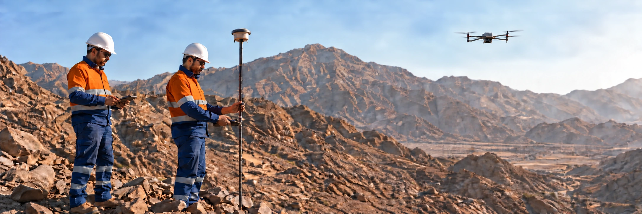
- Positioning: drones with RTK or PPK positioning record the camera position precisely
- Ground control points: surveyed markers on the ground, measured with GNSS, tie the model to real coordinates and check its accuracy
With good planning and ground control, drone models can be accurate to a few centimetres, enough to line up with drill collars and survey control. Without ground control, the models look good but may sit in the wrong place.
Where drones help in exploration
Mapping and targeting
High-resolution imagery shows rock exposure, colour changes, veins and structures across a whole licence. Geologists use it to plan mapping traverses, spot features worth checking on the ground and refine targets before drilling.
Planning access and drill pads
Terrain models show where tracks can go, where pads fit and where slopes or drainage cause problems. That means fewer surprises when the rigs arrive, and less disturbance to the ground.
Keeping records up to date
Repeat flights show how a site changes: new tracks and pads, stockpiles, and later, rehabilitation. That supports progress reporting and the environmental record of the programme.
Safer fieldwork
Every hour a drone saves on steep or unstable ground is an hour a person does not spend there, and in summer that matters.
What drones do not replace
Drones complement ground survey rather than replace it. Drill collars still need a proper GNSS pickup, survey control still has to be established on the ground, and geological observations still need a geologist at the outcrop. Specialist airborne surveys, such as magnetics, use different sensors and planning.
Planning a drone survey in Saudi Arabia
- Define the outputs: which products, at what resolution and accuracy, and in which coordinate system
- Plan the flights: area, flying height, overlap, battery changes and the best time of day for light and heat
- Set out ground control: place and survey markers before flying, spread across the area
- Check the rules: drones in Saudi Arabia are regulated by the General Authority of Civil Aviation (GACA). Commercial survey flights generally need a registered drone and a certified pilot, and some sites and airspace need extra approval, so check permissions early
- Plan for heat and dust: batteries and electronics suffer in extreme heat, so schedule flights for cooler hours and protect the equipment
- Agree the processing and handover: who processes the data, how quality is checked and how it reaches your GIS
What to ask a drone survey provider
- Which drone, camera or sensor will be used, and what ground resolution will the products have?
- How will ground control be set out and surveyed, and what accuracy will be reported?
- Which coordinate system and file formats will you receive?
- Who holds the registration and pilot certification, and who applies for any site approvals?
- How long will processing take, and how will quality be checked before handover?
What drives the time and cost
The size of the area, the resolution needed, the terrain and access, the number of ground control points and the amount of processing all affect how long a survey takes and what it costs. A small drilling area can often be flown in a day, while a whole licence at high resolution may take several days of flying and more processing. Agreeing the outputs first keeps the survey focused on what the programme needs.
How Takween delivers drone surveys
Our surveying and remote sensing team flies UAV surveys over exploration licences and handles the ground work that makes them accurate: survey control, GNSS positioning and collar pickup. The results go straight into our exploration data workflow and to our geologists. Contact us to plan a survey for your licence.